Welcome to the City of Ekurhuleni Geographic Information website.
This interactive website provides access to maps for the citizens of Ekurhuleni, public and private sector.
Online users may query and view maps and data available in the City’s Geographic Information Systems.
Mission
The smart, creative, innovative & centralized GIS to better support the municipality
Vision
To effectively manage Geo-Information & related resources, ensuring timely provision of accurate, complete & consistent spatially referenced data to all stakeholders
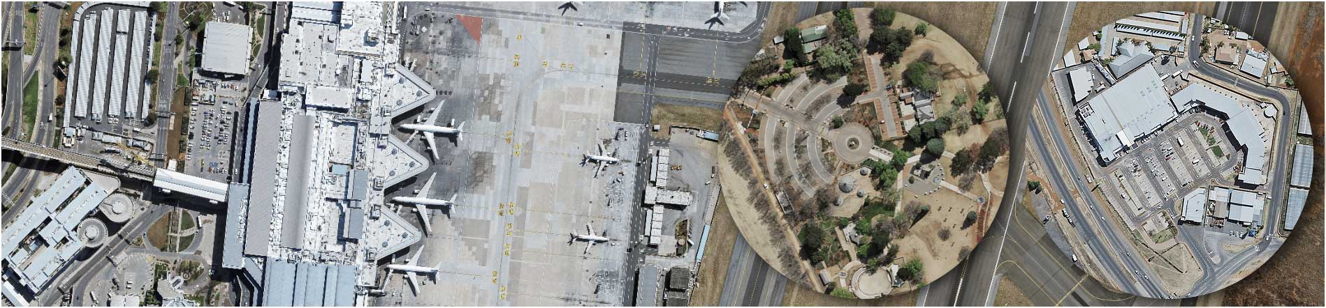
Ekurhuleni Maps, Applications and Data services
To view the map service you require, please select from the options below:
To view the map service you require, please select from the options below:
Overview of Online Map Services
Please note that all layers and sub-layers are located under Map menu
Imagery
Satellite Image 2007
Ortho-Photo June 2007
Ortho-Photo May 2010
Ortho-Photo May 2013
Ortho-Photo October 2015
Ortho-Photo October 2018
Transportation
Roads
Streets
National roads
Railways
Railway stations
Property Data
Addresses
Stands
Zoning
Proposed stands
Townships
Proposed townships
Farms
Municipal Boundary
Municipal Regions
Wards
CCC boundaries
Adjacent Municipalities
Points of Interest
Clinics
Community Halls
Schools
Hospitals
Fire Stations
Police Stations
Stadiums
Airports
Libraries
Tourism Information
Churches
Conservation Areas
Customer Care Areas
Public Swimming Pools
Cemeteries
Environmental data
Hydrology
Ecology
Sensitivity
Air
Noise
Water
Geographical Areas
Spatial Development Framework
Mixed Land Use
Municipal Social Infrastructure & CBD
Dams and Pans
High Potential Agricultural Land
Municipal Open Spaces
Land Uses
Urban Development Zones
LSDF Activity Nodes
Urban Edge 2011
Provincial Urban Edge
LSDF Uses
LSDF Areas
LATEST NEWS AND SERVICES


DISCLAIMER - All rights reserved
The data/Information contained on this GIS Viewer is continuously being verified and updated and is for information purposes only. The accuracy of this data/information can therefore not be guaranteed.
The Ekurhuleni Metropolitan Municipality disclaims all liability for any loss, damage, injury or expense that might arise from the use of any uncertified data/information. Optimized for use with Chrome, Firefox, Edge, Safari 3 and later.
Please note that the use of other browsers may result in an unexpected application behaviour/error. Internet Explorer 9 and later (Compatibility View is not supported) Please note that in order to use the Street View widget, you need to set your browser to "Always Allow" popups from this site. Please ensure that your browsers browsing history setting is set to check for newer versions of stored pages every time you visit the webpage or else set to automatically. For further information on how to modify this setting, please refer to the help file. If using Internet Explorer, please ensure that your browser is not in compatibility mode, and that your pop-up blocker is disabled. Metadata is only provided for the core datasets (stands, zoning, address, and street centerlines) All layers in the map viewer are scale dependent.
When pressing this button the dialog will popup: